Ever since I went to my first Telluride Bluegrass Festival,
the San Juan Mountains have had a hold on me that I can’t shake. They are so beautiful, so intimidating, so
inviting. I have been hooked ever
since. I badly want to run Hardrock one
day, but the lottery gods have not been kind to me thus far (maybe I need to
hang out with John Sharp more). Lucky
for me there is a 50 mile race that some refer to as “Baby Hardrock”. The Lake City 50, now known as the San Juan
Solstice 50, is arguably the toughest 50 mile race in the U.S. (Zane Grey being
the other). Since I had signed up for
Zane Grey earlier in the year, I set my sights on doing San Juan as well. I set my alarm early on the day registration
opened, knowing the race usually fills within an hour. Luckily for me, I was able to secure a slot early,
assuring me of running in my favorite mountains in late June.

I knew the
steep climbs would be an issue in the race, but I was more concerned with the
altitude, the low point being 8,671’ (in town) and a high of 13,334’. The race boasts nearly 13,000’ of climbing
and the same in descent, meaning my quads would take a beating. Having rented a house in Ouray for a couple
months, I had the chance to adjust to the higher elevation and also to venture
into the high country (climbing three 14ers) since there was virtually no snow
in the area. I hoped my 2+ weeks of
living at 7700’ would give me an advantage over my other Texas friends who were
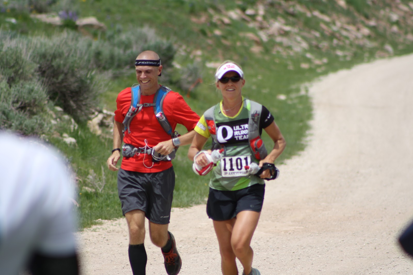
running the race with me. After making
the 3 hour drive to Lake City from Ouray, I picked up my packet (noticing that
everyone there looked really fit and in shape) and met fellow Texans John
Sharp, Mike Sawyer, and Jaime Garcia for a beer at the local saloon (yes, a
saloon). Soon I was back at the cabin
and in bed, hoping to catch a few hours of sleep before the 5AM start.

(Course Profile on Back of Shirt)
I awoke to cool (but not cold) weather and clear skies. It was still dark, but we were told it should
be light enough by the start to not need a headlamp. This was good, because I really didn’t want
to carry a headlamp only to turn it off after 20 minutes and be stuck carrying
it for 15 miles. Having been warned that
the first aid station would only fill one bottle per runner (all the aid had to
be hiked into this station, which was a 3,000’ climb from town), I decided to
carry my Ultimate Direction pack in addition to 2 handheld bottles filled with
Carbo Pro. I would have more Carbo Pro
waiting for me at mile 15 (Williams Creek) and mile 21 (Carson). After that, I would rely on whatever food was
at the aid stations, plus a few snacks I would bring along. I wished John and Jaime luck and lined up
next to Mike Sawyer, who was trying out a new pack (same Ultimate Direction
Wasp I use) and was having trouble getting it adjusted comfortably. Not a minute after we started the race, I
looked over and noticed that Mike’s pack was unzipped, most likely the cause of
his discomfort. We stopped so I could
zip him up and then laughed because we were now officially DFL. The first 2-3 miles were run on an easy jeep
road that climbed ever so slightly, allowing us to ease into things and let our
legs warm up by jogging. It also allowed
runners to spread out a bit and get “in position” for the big climb that would
come once we turned onto the trail. After
10-15 minutes, Mike slowed to catch his breath (coming from close to sea level
is tougher than it sounds), and I continued on.
After almost 30 minutes of jogging up the road, we hit the turnoff for
the Alpine Gulch trail, which would take us up…and up…and further up.
The race
director had warned us that, although the stream crossing would not be as high
as previous years (this year had been very dry), we would almost certainly get
our feet wet in the early section of the race, noting that it would be easier
just to wade across than try to balance on the potentially icy logs that might
be available. We came to the first
crossing, and I scurried across the logs with no problem, managing to stay
dry. Same thing at the next crossing. Maybe I would stay dry today after all. As soon as we came to the 3rd
crossing, I knew my luck had run out.
The previous 2 had nice wide logs that were a couple feet above the
stream. The crossing I was currently
faced with had several skinny (think a couple inches wide at best) logs that
hovered 3-4 feet above the ice cold water.
Unless your name was Mary Lou Retton, you were going to have difficulty
balancing on this thing. So, I splashed
through the creek, which was cold but felt quite good. Now that my feet were wet, I didn’t hesitate
at any of the other crossings, choosing to bypass the skinny logs and wade
across. This section of trail was really
nice singletrack, which forced us to form a long line as we climbed the steep
slope. I felt really good, and badly
wanted to pass people, but I kept reminding myself that there was plenty of
race left and that I would have many opportunities to pass if I continued to
feel good. I was encouraged that my legs
felt great and my breathing wasn’t labored at all. I guess the 2+ weeks I had spent at altitude
was paying off. 7 miles after race
started, we arrived at the Alpine Gulch aid station, where I topped off my one
allotted bottle and headed out.

(Early Climb Towards Alpine Gulch)

(Looking Down From Where We Began)
Soon we were above treeline, and this is where the real
beauty began. 360 degree views of huge
mountain peaks, blue sky as far as the eye could see. This is why I love running in the
mountains. I remarked how beautiful this
was to the guy in front of me, who replied, “yeah, this is Sound of Music kind
of stuff”. We continued to climb
up. At times we left the trail and
headed up to a new trail, marked only by an occasional race flag. We would continue along the ridge, then up to
a new ridge. It was a very new
experience for me, but one I was enjoying.
Because of the early spring in the San Juans, the wildflowers were
already out, coloring the mountainside and providing the perfect backdrop. Soon we topped out at the high point on the
course, then began the first of several quad crushing descents, this one taking
us below timberline and into the first major aid station of the day, Williams
Creek, at mile 15.7.

(Runners Look Like Ants Running to the Ridge)


(No Trail, Just Go Up)

(Some Early Ridge Running)


(Wildflowers Abound)

I arrived at Williams Creek in just over 4 hours, pleased
that I had felt pretty good up to this point and had still made decent
time. I knew I would slow down, but I
was happy with my race so far. I quickly
ditched my UD pack for a waist pack that held 2 bottles of Carbo Pro and some
other items, plus 2 additional handhelds (4 total) of Carbo Pro. As I was leaving Williams Creek, I saw a familiar
face up ahead. John Sharp had left just
seconds before I did, meaning I was either running way too fast early on or he
was struggling. After a few minutes I
caught up to him, learning that the altitude was wreaking havoc on his
breathing. Making these climbs is tough
enough with good lungs, but doing so on limited breathing is nearly
impossible. I wished John luck and
pressed on ahead. The next section was
yet another climb, this one on a jeep road up past the ghost town of Carson
(where we would have an aid station) and eventually onto the Continental
Divide. I was excited to see the Divide,
if not overly thrilled about the climb needed to get there. I usually do well on jeep roads, as they are
generally easier to climb than a steep, narrow stretch of singletrack. This jeep road was way worse than I
expected. Rutted, rocky, steep, and
hot!!! I realize I will get no sympathy
from those who ran Pedernales, but it was really hot that weekend in
Colorado. mid to upper 80’s feel toasty
when you are above 10,000’. This road
felt like it would never end. I was
thirsty, but all I had was Carbo Pro.
Although it is generally tasteless, I couldn’t seem to make myself drink
it. I sipped pitifully on my bottles,
not wanting to drink it but knowing I was on the road to dehydration. I would walk a few minutes and then stop in
the shade for a brief moment. This
continued for what seemed like an eternity.
Finally, I saw volunteers at the Carson aid station, where I knew I
could drink plain water and try to re-group.
As soon as I got there, a really nice volunteer asked if I was
Brian. It took me by surprise a bit, but
I replied yes, and he told me he knew me from Liza and a class she had
taught. I sat down and let Fritz fill my
bottles and get me a slice of watermelon.
We chatted for a bit as I drank, and then I grabbed a few items from the
aid station table and set out on my way (we still had 1500’-2000’ left to climb
before we hit the Divide.

(Climbing Out of Carson Aid Station - Heading to the Saddle on the Left)

(Looking Back Down on the Trail That Led To the Divide)
This next section was supposed to
be a tough one because it would be 9+ miles before we hit the next aid station,
and we would be running along the Continental Divide at close to 13,000’ for
much of it. Dreading the remaining
climb, I managed to push on as visions of the Divide danced in my head. Not too far past the aid station I noticed
another runner sitting in the shade. At
first I thought he was using an inhaler (I had just used mine as well), but as
I got closer I realized he was inhaling something entirely different. As I passed by, he commented that it helped
settle his stomach. Only in Colorado J Up and up I went. Somewhere just below the Divide, I started to
feel nauseous. It came on suddenly, but
I knew the feeling all too well. I
pulled of to the side of the trail and emptied what little food and fluid I had
managed to take in at Carson. Now I was
right back where I had been earlier.
Sure, I felt better, but I was on the verge of dehydration and had
insufficient calories in my system.
Nothing to do but keep going.
When I finally reached the Divide, all my worries about calories went
away. For a moment I just stood there in
awe of the beauty laid out before me. The
views were limitless in all directions.
I could see nearby 14ers, far away peaks, and beauty beyond
description. To say the trail on the
Divide was a bit sketchy would be an understatement. My reward for having climbed up past 13,000’
again was a rugged, tundra-like atmosphere.
There were sections where no trail existed, and I found myself scanning
the ground for rock cairns or flagging. I
ran over grass, rocks, and wildflowers.
Where trails did exist, they were often rugged and lined with
rocks. This continued for the next 5+
miles, during which time smoke from nearby fires (they are everywhere in CO
right now) blew in, casting an eerie haze over the mountains. I never felt like the smoke bothered me, but
many runners complained about it, and I heard ash was falling on people at the
last aid station. It’s a sad
situation. Along the way I stopped and
got sick again. I also ran into 2 ladies
I had seen at Zane Grey. One had been on
the verge of dropping out as she was out of water in the heat of the day, 3+
miles from the next aid station. I had
given her one of my bottles, and she remembered me and thanked me. Another woman had run Bighorn (yes, the 100)
the weekend before. Wow! She was training for the Rocky Mountain Slam
(Bighorn, Hardrock, Leadville, Wasatch, Bear).
Just when you feel like you might be doing something remarkable and
somewhat impressive, you meet someone like that to bring you back down to
earth. We began to descend, and I hoped
the aid station was nearby, as I was getting thirsty (I had tried to ration my
water) and knew I needed some solid food.
This stretch seemed to go on forever, but once we descended through the
trees and emerged in a meadow, I could see a few cars and knew we were at the
Divide aid station, 31 miles (and nearly 10 hours) into the race. I was happy to find out they had soup here,
and I quickly downed 2 cups, washing it down with a bottle of water and some
Mountain Dew. I thanked the volunteers
(they were fantastic all day) and was on my way.

(Running Along the Continental Divide)

(Sometimes the Trail on the Divide Looked Like This)

(And Sometimes Like This)


(Smoky Haze Rolling In)
The next section was again a 9 mile stretch without aid, but
this time there would be a good bit of downhill, so I wasn’t as concerned. I settled into a nice power hike (I trained
under the master, Chris Russell) and was soon feeling much better. I decided it was time to break out my secret
weapon, my iPod. As soon as my music was
on, I started feeling better and began to run again, slowly at first but then a
little quicker. I started passing people
and putting distance on them. After a
few miles of this, the real downhill began (we would drop almost 4,000’ to the
last “big” aid station at Slumgullion Pass).
The trail/road down was not an easy one, as it was rocky and uneven, but
it was still faster than climbing. I had
a time in my mind in which I thought I would reach Slumgullion, so I was
pleasantly surprised to see the aid station appear before me a good 10 minutes
earlier than I expected. I again downed
some soup and Mountain Dew, dropped my waist pack, and headed out with 2 fresh
bottles of water.

(The Descent Into Slumgullion)
I knew I had one last climb to tackle, but this one would be
an “easier” one, only taking me up 1700’.
Because the last section was on provide property (Vickers Ranch), we had
a good bit of bushwhacking and off trail maneuvering just to get onto the trail
at the property. Once there, we climbed
up through aspen groves that were stunning.
I had felt decent coming out of Slum, but just as quickly I got that all
too familiar feeling in my stomach and pulled to the side to do my
business. Afterwards, I felt much better
but knew I was yet again digging myself a caloric hole. I still managed to pass several people on
this section, finally cresting the hill and finding the last aid station at
mile 46. I filled a bottle with water
and another halfway with Mountain Dew and took off. I had enjoyed 99% of this race, but I was
ready to be done!

(The Climb Up Vickers)
I continued my walk/run, eventually settling into a nice
rhythm as I ran downhill through the trees.
About 2 miles from the finish, I passed a guy who would stay with me the
rest of the race. When I ran, he ran. When I walked, he walked too. This was actually good for me as it probably
forced me to run a bit more than I normally would have. The last few miles were fairly
uneventful. We hit the streets of Lake
City and wound our way towards the park, where many people had stayed to cheer
runners on. I crossed the line in 14:52,
not quite what I had hoped but still a decent time.

(Approaching the Finish)
Overall I was pleased with my race, though obviously not
with my stomach issues. The course is by
far the most scenic I have ever run. My
legs felt pretty good for most of the day, except when I lacked energy due to
nutritional issues. Altitude never
seemed to be an issue, or if it was it wasn’t debilitating. Whatever the case, I got to spend a day in
the middle of the San Juan Mountains, which is darn near perfect in my book.